


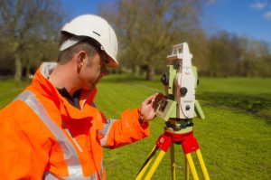
The Importance of the Right Surveying Approach in the UK
In the United Kingdom, a country known for its rich history and diverse landscape, surveying plays a vital role in a wide range of industries, including construction, land development, infrastructure planning, and environmental management. The process of surveying involves the measurement and mapping of the Earth’s surface to gather essential data for decision-making. However, it is crucial to recognise that the right surveying approach is of utmost importance to ensure accurate and reliable results. In this blog post, we will explore the significance of employing the right surveying approach in the UK, highlighting its benefits and implications for various sectors.
Ensuring Accurate Land Mapping and Planning
Effective land mapping and planning are fundamental to the successful execution of any construction or development project. By utilizing the appropriate surveying approach, professionals can obtain precise measurements, allowing for accurate mapping of land boundaries, topography, and existing infrastructure. This information enables architects, engineers, and urban planners to make informed decisions during the design and development phases. Accurate land mapping also facilitates effective land use planning, leading to efficient resource allocation and sustainable development practices.
Find out more about Topographic Surveys
Supporting Infrastructure Development
Infrastructure development, including roads, railways, bridges, and utilities, relies heavily on accurate surveying data. The right surveying approach helps engineers and infrastructure planners identify the most suitable locations, assess potential environmental impacts, and design infrastructure projects that are safe, efficient, and cost-effective. Surveying techniques such as laser scanning and aerial surveys provide comprehensive data, enabling detailed analysis of the terrain and identification of potential obstacles or risks. By employing the right surveying approach, the UK can effectively manage its infrastructure development, leading to improved transportation networks and enhanced connectivity.
Find out more about Architectural Surveys

Facilitating Environmental Management and Conservation
In an era where environmental sustainability is a global priority, the role of surveying in environmental management and conservation cannot be overstated. Surveyors employ specialized techniques to monitor and assess environmental conditions, including land use changes, biodiversity, and natural resource management. By accurately measuring and monitoring these factors, surveyors can contribute to the identification and protection of ecologically sensitive areas, supporting sustainable development and conservation efforts. The right surveying approach enables comprehensive data collection, facilitating informed decision-making and ensuring that environmental considerations are integrated into various projects and initiatives.
Enhancing Flood Risk Assessment and Management
Flood risk assessment and management are crucial in a country prone to variable weather patterns. By employing advanced surveying techniques such as LiDAR (Light Detection and Ranging), surveyors can collect detailed elevation data, enabling accurate modelling and mapping of flood-prone areas. This information assists authorities and policymakers in developing effective flood mitigation strategies, improving emergency response planning, and enhancing the resilience of communities in flood-prone regions. The right surveying approach provides valuable data for flood risk assessment, aiding in the reduction of potential damages and ensuring the safety of residents.
Surveying serves as a cornerstone for numerous industries in the UK, contributing to the successful execution of construction projects, infrastructure development, environmental management, and risk assessment. By utilising the right surveying approach, professionals can gather accurate and reliable data, facilitating informed decision-making and enabling sustainable development practices. The importance of employing the appropriate surveying techniques cannot be overstated, as it ensures precise land mapping, supports infrastructure development, facilitates environmental management, and enhances flood risk assessment. As technology continues to advance, surveying approaches will evolve, providing even greater benefits to the UK and its various sectors.
For mote information please contact us today.