


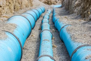
Beneath our feet lies a hidden labyrinth of vital infrastructure that powers our everyday lives. From water pipelines to electrical cables, underground utilities form the backbone of modern society. However, accurately mapping this underground maze is a complex task. In this blog, we will delve into the fascinating realm of utility mapping surveys and explore how they are crucial for efficient and safe infrastructure management. If you’re ready to uncover the secrets below ground, contact PLS Geomatics for more information.
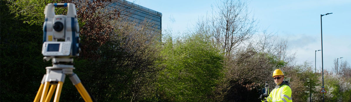
Understanding Utility Mapping Surveys: Utility mapping surveys are comprehensive assessments conducted to identify and map the precise location of underground utilities. Utilising advanced technologies and techniques, these surveys provide accurate data on utility presence, type, depth, and condition. The information gathered plays a vital role in informed decision-making for utility companies, construction professionals, and infrastructure managers during planning, maintenance, and expansion projects.

The Importance of Accurate Utility Mapping: Accurate utility mapping holds immense significance for several reasons. Firstly, it helps prevent costly and hazardous accidents during excavation and construction. By knowing the exact location of utilities, contractors can avoid accidental damage, minimising service disruptions, safety risks, and financial liabilities.
Secondly, utility mapping surveys facilitate efficient planning and design of infrastructure projects. Whether it’s installing new utilities, expanding existing networks, or designing transportation systems, precise knowledge of underground utilities streamlines processes, minimises delays, and reduces overall project costs.
Thirdly, utility mapping supports asset management and maintenance activities. Regularly updating utility maps and monitoring the condition of underground assets allows utility companies to prioritise maintenance efforts, extend infrastructure lifespan, and ensure optimal service delivery.
Technologies Utilised in Utility Mapping Surveys: Utility mapping surveys employ a range of advanced technologies to collect accurate and reliable data. Some commonly used techniques include:
- Ground Penetrating Radar (GPR): Using electromagnetic waves, GPR creates subsurface profiles and detects underground utilities by identifying material variations and buried objects.
- Electromagnetic Locators (EML): EML devices detect electromagnetic fields generated by buried utilities, enabling surveyors to trace their paths and mark their precise locations.
- Radio Detection (RD): RD technology identifies and locates metallic utilities using radio frequency signals, making it particularly effective for detecting metallic pipes and cables.
- Global Positioning System (GPS): GPS technology provides precise positioning and mapping of utility assets, offering accurate coordinates to create detailed utility maps.
Benefits and Future of Utility Mapping Surveys: Investing in utility mapping surveys yields numerous benefits for both public and private entities. By minimising the risk of accidents, these surveys protect workers, reduce project delays, and save costs associated with repairs. Moreover, improved knowledge of underground utilities promotes efficient planning and resource allocation.
Looking ahead, emerging technologies such as augmented reality (AR) and artificial intelligence (AI) hold significant potential for enhancing utility mapping surveys. AR can overlay virtual utility data onto real-world views, providing intuitive and immersive visualisation. AI algorithms can analyse survey data to detect anomalies, predict maintenance needs, and optimise asset management processes.

Unveil the Underground World with PLS Geomatics: To navigate the complex realm of utility mapping surveys and unlock the full potential of your infrastructure projects, it’s time to reach out to PLS Geomatics. With their expertise, cutting-edge technologies, and commitment to precision, PLS Geomatics is your trusted partner in unravelling the hidden depths of underground utilities. Contact them today to embark on a journey of comprehensive utility mapping and ensure the resilience and sustainability of your infrastructure for generations to come.
Benefits and Future of Utility Mapping Surveys: Investing in utility mapping surveys yields numerous benefits for both public and private entities. By minimising the risk of accidents, these surveys protect workers, reduce project delays, and save costs associated with repairs. Moreover, improved knowledge of underground utilities promotes efficient planning and resource allocation.
Looking ahead, emerging technologies such as augmented reality (AR) and artificial intelligence (AI) hold significant potential for enhancing utility mapping surveys. AR can overlay virtual utility data onto real-world views, providing intuitive and immersive visualisation. AI algorithms can analyse survey data to detect anomalies, predict maintenance needs, and optimise asset management processes.
Unveil the Underground World with PLS Geomatics: To navigate the complex realm of utility mapping surveys and unlock the full potential of your infrastructure projects, it’s time to reach out to PLS Geomatics. With their expertise, cutting-edge technologies, and commitment to precision, PLS Geomatics is your trusted partner in unravelling the hidden depths of underground utilities.
Find out more and contact us today – Contact Us